

Tropical cyclones are the most powerful storms on the planet. They are amazing machines, heat engines running off of the hot, moist air of the tropics. There is plenty of information on these storms on the internet to keep track of their formation and where they are headed--well, at least that is the objective. Like supercells on the great plains, these storms are so complex that we yet poorly understand them--we don't know exactly when they will form, we know when the conditions are favorable. We don't know where they will go, we can simply put a nice cone on the map to show the possibilities.
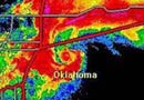
I put together a comprehensive review of Tropical Storm Erin in Oklahoma .
Best Sources
The first site to highlight is the National Hurricane Center. They are the professionals; it is their job. All other sites are less trust-worthy than they (I hope). Here is the current graphic for the probability of formation of tropical cyclones in the next 48 hours:

Go to their site for all official warnings from the National Weather Service, of which they are a part.
My most-used site for tropical weather is Dr. Jeff Masters' WunderBlog at the Weather Underground. He is an expert forecaster for tropical weather and writes excellent summaries of what is going on. In addition, people comment about the tropical weather below his blog in the comments section. This is greatly useful as well; there are a number of very capable people within the comments discussing things. There are also plenty of people who don't know much, or "trolls" that come through and try to rile people up by crazy forecasts. Take what is said in the comments with a grain of salt--nevertheless, Jeff Masters' blog and comments is by far my most-used tropical weather site.
I post on his WunderBlog every once in a blue moon... primarily I just use it for all of the information and good links posted by everyone. Often there are people quite near the storm posting updates. Usually there are many comments per minute when a storm is getting close... I use the filter function at the top of the comments page to filter out comments from posters that have been flagged as "below-average" or worse by fellow commenters. That usually takes care of most questionable people and posts.
Other people on the WeatherUnderground also post excellent information, if they are around. These are relative amateurs, primarily simply collecting material for others to evaluate. Their forecasts are not official, but usually they are experienced enough to do a good job. These WunderBlogs:
- StormW's WunderBlog (A featured blog by a "retired" forecaster--a convenient list of tropical acronyms and his forecast)
- TampaSpin's WunderBlog (Usually a vast collection of images and information)
- WeatherGuy03's WunderBlog (Another good collection of information and a forecast)
The Weather Underground site itself has an excellent Tropical Weather section with information on storms. The WunderMap is particularly interesting if the storm is near or over land. Their computer model graphic is also useful for checking out the possible tracks of the storm according to the best computer models, which are not necessarily right. At the bottom of the Tropical Weather page is an excellent collection of links.
There is a comprehensive FAQ at the Hurricane Research Division of the Atlantic Oceanographic and Meterorological Laboratory which answers just about any questions about tropical cyclones. Excellent.
And now to a more mundane list of sources for useful information.
Imagery
NOAA Geostationary Satellites: Atlantic and Caribbean Tropical Satellite Imagery - Satellite Services Division A site with "floaters", satellites that float above the storms providing satellite views. Plenty of options on the color enhancement curves.
Interactive Weather Satellite Imagery Viewers from NASA GHCC A site with the highest resolution, zoomable, quickest-updating satellite imagery.
CIMSS Tropical Cyclones A site with lots of imagery, particularly microwave. The MIMIC-TPW (Total Precipitable Water) images are splendid, helping one visualize the atmosphere.
Naval Research Lab (NRL) Satellite Products An amazing collection of satellite data, with nice large-size images. Plenty of easy-to-load, long-term loops.
Navy/NRL Tropical Cyclone Page A page with access directly to the microwave images of several satellites. Particularly note the Multi-Sensor images.
Real-Time Tropical Cyclone Products A page with access to a number of real-time graphics and plots. Also see Tropical RAMSDIS Online for more information at that site with different imagery.
Satellite Imagery - Environment Canada A nice selection of fairly high-resolution satellite imagery.
Hurricanes - Earth Scan Laboratory, LSU A collection of imagery and plenty of other information.
Layer Mean Wind Atlantic Steering Images showing the steering at different layers of the atmosphere. Useful in determining short-term track.
Models
Tropical Cyclone Genesis Potential Fields A collection of most of the models used.
Unisys Weather: Models Use the links in the menu to look at various models.
Florida State: Forecast Weather Maps A nice collection of model-run imagery.
Penn St. Tropical Atlantic e-Wall Model imagery and comparisons.
Plots of Tracks at South Florida Water Management District
Tropical Atlantic Model Page Lots of links to various models and model sites.
Google Earth
Tropical Atlantic Overlays A massively comprehensive collection of layers. Not everything of the best quality, but the Recon Data Decoder for Google Earth is the best Recon Decoder available online that I have seen. It collects the data within a few minutes from the Hurricane Hunter aircraft and plots it all out for the user to see in Google Earth.
guiWeather Google Earth Overlays A very nice looking collection of some of the most-used information. The model tracks and forecast cone are a must, and the Level II radar data seyp is very sharp (but seems to crash my Google Earth eventually).
National Weather Service Radar for Google Earth The official NWS radar data for Google Earth.
Realtime WDSSII Weather Data Excellent data from the Severe Storms Lab.
Et Cetera
Storm Junkie.com: Quicklinks A wall of links to useful tropical info, like this one only different and more comprehensive.
Web-based Tutorials on the Use and Utility of GOES Imagery Several nice tutorials on GOES Satellite data.
Jonathan Vigh's Tropical Cyclone Page Lots of links.