

Tornados have always been of interest to me, since I have lived in the heart of tornado alley all my life. Here are some pictures and radar images of some notable tornados. Storm News and Archives
May 3, 1999
This tornado was the nearest we have been to trouble. Michael and Dad and I were golfing on Lakeside, a nine-hole course in Moore, as the storm approached. The wind was strong, and the clouds were moving fast in several different directions, so we stopped after the first nine to see if there was a storm approaching. We putted around the practice green and debated whether to go on. But then Dad heard a distant rumble of thunder, which decided the question. It is always difficult to quit after nine holes when one has aid for eighteen, but we hadn't been playing very well, and the sky had taken on a rather ominous aspect. Thus, as we left, Dad warned a couple of teenagers that werehanging around the parking lot that it might be best to seek cover.
On the way home we turned on the radio and heard that there was a tornado on the ground near Chickasha, about forty miles to the southwest. Storms in Chickasha always travel our direction, so when we got home we turned on the TV and watched as the storm moved in our general direction with the tornado still on the ground. Once the tornado reached Newcastle, about 12 miles due west of us, we knew that it would pass us to the north, so we turned off the TV and ate dinner. When we turned on the TV again an hour later, all that remained was a path of devastation through Moore and south OKC. Many other tornados were still around, and we continued watching for some time, though all stations focused on the trail left by the big one. In all, there were 66 tornados that day, put down by 11 different supercells. We soon realized that the golf course we had played at that day was no more. Lakeside was demolished by the storm. The cinder block clubhouse absolutely disappeared, along with the trees on half the golf course and the carts. All that was left was the slab foundation. The tall metal polls surrounding the driving range were either broken off and carried away, or bent at weird angles. The pieces of wire netting that remained on the poles was covered with scraps of insulation. Toward the back of the course was the remnant of a large tree: All branches were broken off, and the bark stripped off. All that remained was a gnarled trunk with a metal frame of something wrapped around it. The ponds were all filled with debris, and when we played on the "rebuilt" course in the spring of 2003 they had drained one pond to reveal an enormous amount of oddly twisted pieces of metal and other heavy debris. We saw one shoe, a roller conveyor belt, and piles of shingles. And we had been at that course only a few hours before all this happened!
Pictures and graphics of the tornado (click to enlarge):
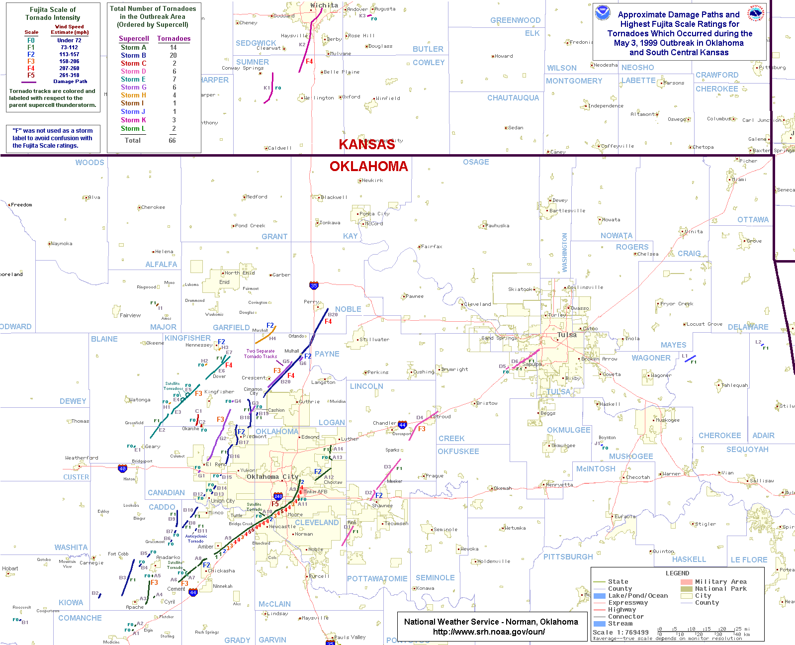 Damage
path map showing Fujita scale ratings.
Damage
path map showing Fujita scale ratings.
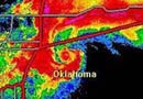
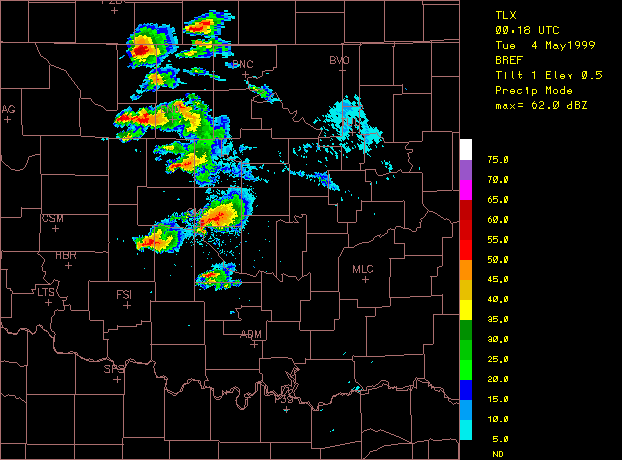 May
3 Radar image as the tornado plowed through Moore.
May
3 Radar image as the tornado plowed through Moore.
 May
3 radar video. Warning: large file size (2.7 mb.)
May
3 radar video. Warning: large file size (2.7 mb.)
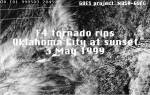 Satellite
view of the May 3 Storms. In .mov format; QuickTime or other
player required.
Satellite
view of the May 3 Storms. In .mov format; QuickTime or other
player required.
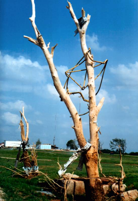 Picture
of a tree on the golf course, Lakeside, in Moore.
Picture
of a tree on the golf course, Lakeside, in Moore.
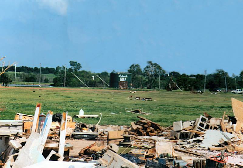 Picture
of Lakeside #2.
Picture
of Lakeside #2.
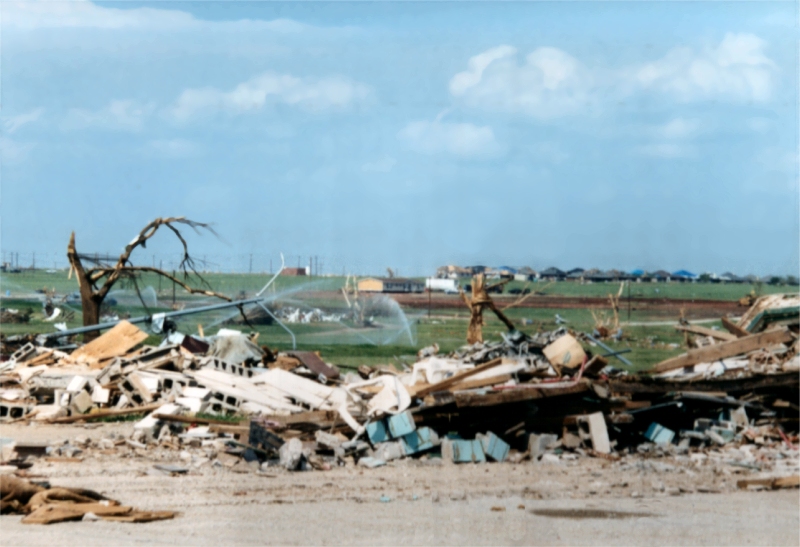 Picture
of the clubhouse.
Picture
of the clubhouse.
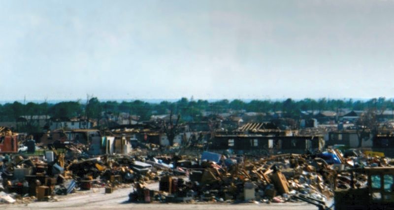 A
view south off the Shields Blvd. bridge at I-35 down the damage path.
A
view south off the Shields Blvd. bridge at I-35 down the damage path.
Links:
NWS Norman, Oklahoma--The Central Oklahoma Tornado Outbreak of May 3, 1999
NSSL SWAT Case Study--03 May 1999 Oklahoma City Tornado Outbreak
NSSL May 3 1999 Tornado Headlines
October 9, 2001
In fall of 2001, during an outbreak of supercells, Cordell, a small town in western Oklahoma, had a swath cut through it by an F3 tornado.
Pictures and graphics of the tornado (click to enlarge):
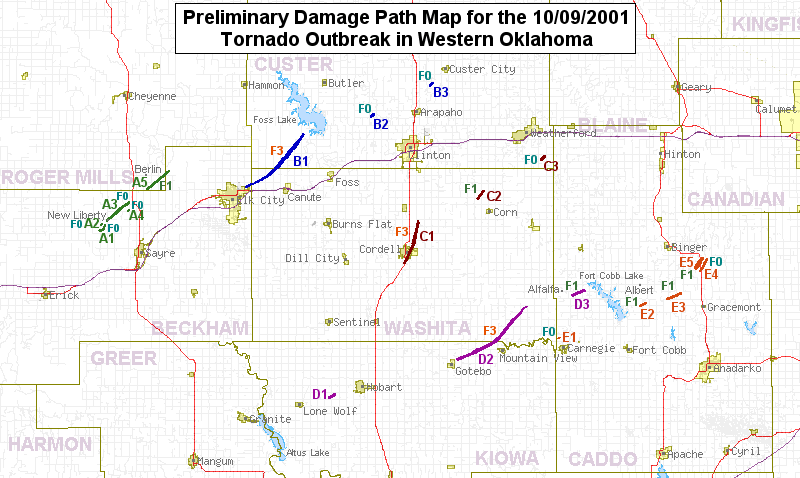 Outbreak
damage path map
Outbreak
damage path map
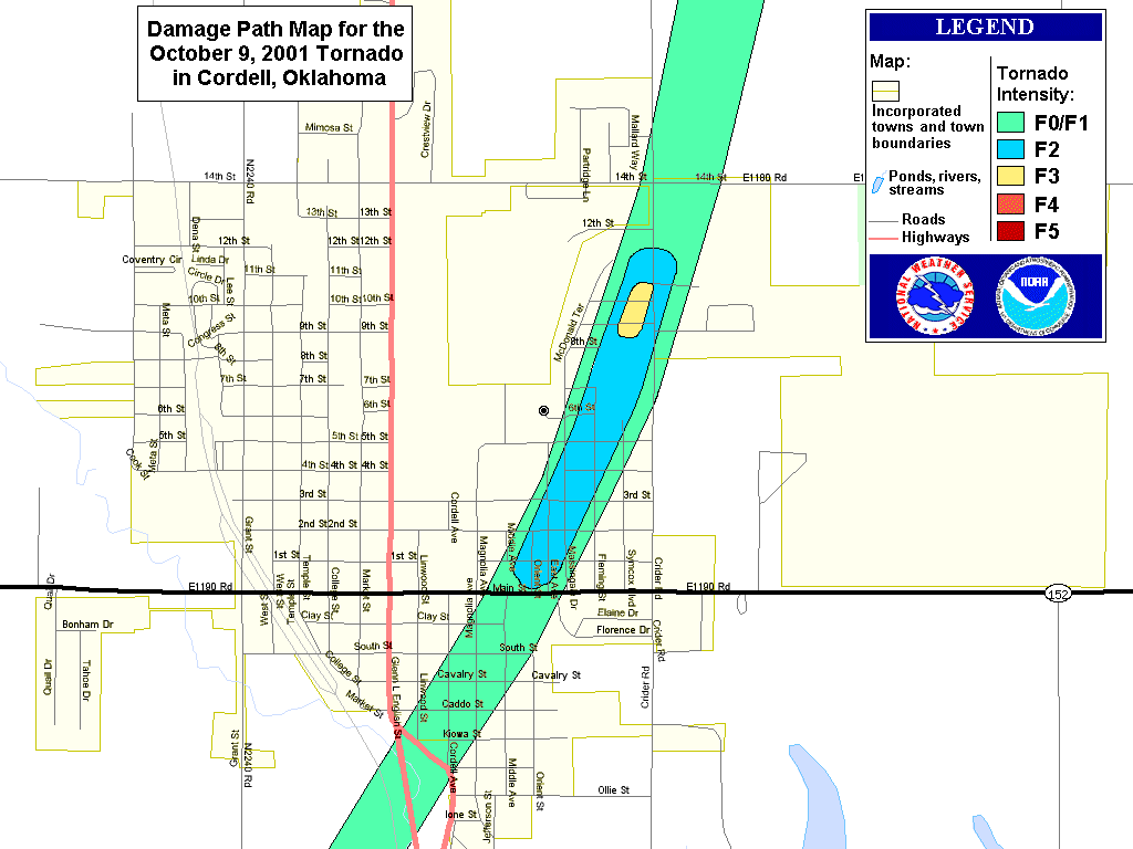 Cordell
close-up damage path map.
Cordell
close-up damage path map.
Links:
NWS Norman, Oklahoma--The Western Oklahoma Tornado Outbreak of October 9, 2001
May 8, 2003
This was a really strange feeling day. I wrote this that evening:
Today was incredibly humid--it was foggy all day, with whipping and swirling winds. It was about 90 for the high, and perhaps 70 for the low.
Everything was pretty calm until fourish, when we heard a steady rumble of thunder. Naturally I checked the TV for storm updates. All of the major stations were on storm coverage--of a single, small storm about 20 miles by 20 miles that had popped up in the last 30 minutes. It was over Newcastle, the town across the South Canadian directly west on Norman. And it was shaped like a cornucopia: a sure sign of trouble. The hook echo was developing. The weather choppers were hovering outside the hook, watching and waiting. The storm chasers were on the ground in their SUVs following the hook area. (The hook refers to a peculiar shape on the radar image of the storm, always at the SW edge.
The meteorologists were analyzing the wall cloud in the middle of the hook, considering its organization--getting clearer and clearer as the rotation increased. Then the tornado dropped--or actually, as is usually the case, debris started getting ripped up and swirled upward--to the yells of the storm chaser on our favorite channel, who was only a few hundred yards off as the transformers blew and the electric poles got snapped. Then the tornado got lost for a moment--then landed squarely in a residential area and was off to the races.
There was a lot of spectacular footage shot as the tornado followed the famed May 3rd Tornado's track. The tornado got more and more powerful for several minutes, plowing through Moore (again) and then heading toward Tinker Air Force Base. On the way, it became wrapped in rain and haze.
Then it hit the GM plant, throwing up such a plume of debris that it was visible on radar. Tinker escaped, again, as the tornado jumped it and landed on the other side and left the OKC area. The sky camera in Choctaw got an excellent view as the tornado bore down on it, blowing transformers every few seconds. Of course, then the transformer powering the camera got blown, and who knows what happened then.
The count is 113 injured, 20 critically, and 1 unconfirmed fatality. It appears there are some two or three hundred buildings destroyed, perhaps more. The GM plant will be out of commission for a while, as one end was crushed.
Actually, the damage path was quite narrow, perhaps a few hundred yards. It wasn't nearly as bad as the 10,000 homes destroyed and 43 people killed on May 3rd 1999.
They are still covering the disaster areas right now. The response times here are incredible. There was about 15 minutes warning for the tornado, and the police and fire departments had people out helping as soon as the storm had cleared each area.
The storm disappeared with the sun.
Pictures and graphics of the tornado (click to enlarge):
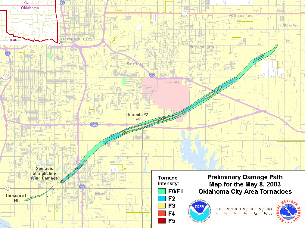 May
8 track.
May
8 track.
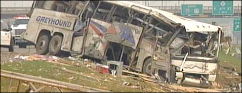 A
greyhound bus tossed off the interstate by the tornado. No
one was hurt.
A
greyhound bus tossed off the interstate by the tornado. No
one was hurt.
Links:
NWS Norman, Oklahoma - Preliminary Information for the May 8, 2003 Oklahoma City Area Tornados
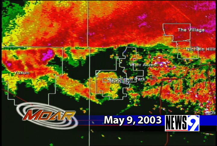
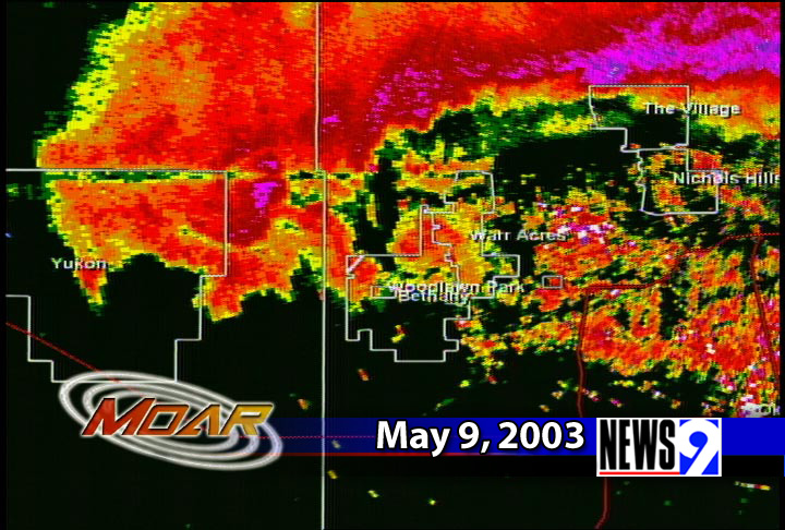
May 9, 2003
This tornado was very powerful, but only touched down momentarily.
Pictures and graphics of the tornado (click to enlarge):
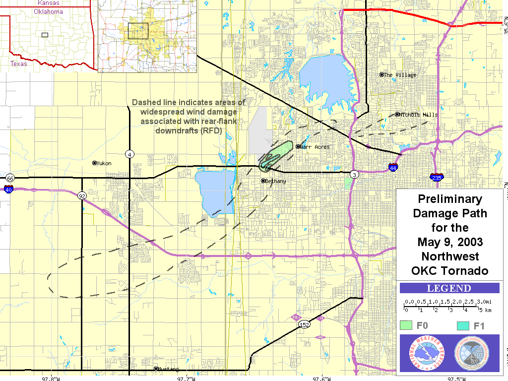 May
9 NW OKC path.
May
9 NW OKC path.
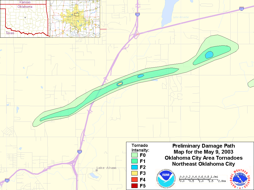 May
9 NE OKC path.
May
9 NE OKC path.
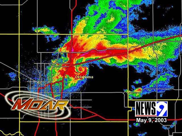 MOAR
radar view of the storm from the radar under development at News9.
MOAR
radar view of the storm from the radar under development at News9.
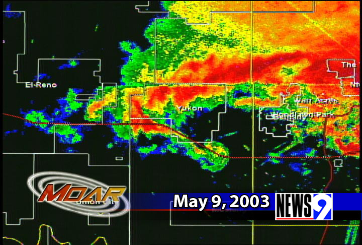 Additional,
close up views:
Additional,
close up views:
Links:
NWS Norman, Oklahoma - Preliminary Information for the May 9, 2003 Oklahoma City Area Tornados